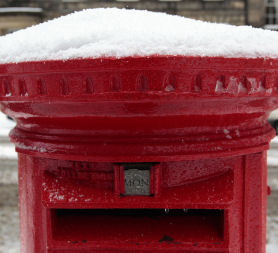
UK snow: temperatures hit record low
Temperatures fell to record lows across the country last night, including -17C in Wales, as heavy snow continues to fall in Scotland, Northern Ireland and the north east of England.
With severe weather warnings in place across the UK, Llysdinam near Llandrindod Wells recorded a temperature of -17.3C, the principality’s lowest temperature for November. It makes this month the coldest in the UK since 1985.
Temperatures in Shawbury, Shropshire, also fell to -12.5C, -11.9C in Church Fenton, North Yorks, and in Northern Ireland, -9.2C was recorded in Lough Fea.
Over a foot of snow has now fallen in parts of Scotland and North East England since the big freeze hit the UK.
The AA had dealt with 12,000 breakdowns by 3.30pm today. A spokesman said this morning: “It’s been another very busy morning. Wales and the eastern coast of Scotland have been the worst affected but it has been pretty busy across the country as a whole.
“We’re also expecting a busy morning tomorrow as people head back to work, particularly if cars have been left sitting over the weekend.”
As snow covers the UK Channel 4 News asks if councils have enough grit. Read more: Where is the grit?

He urged people to check their cars over, carrying warm clothing and a blanket in the boot, and make sure their mobile phones are fully charged.
One driver is fighting for his life after he was injured in a four-vehicle collision on the M1 near Sheffield this morning. His car skidded on ice and came to rest on the hard shoulder, and a lorry driver stopped to see if he was all right.
Two other cars collided head on when one span on the ice. One rebound into the two men on the side of the road. The lorry driver has been taken to hospital suffering a broken leg, and the other drivers and passengers were treated for minor injuries.
All three lanes of the southbound carriageway between junctions 34 and 33 near the Tinsley viaduct at Sheffield were closed following the pile-up.
The East of England Ambulance Service also recorded a spate of traffic collisions yesterday, with cars skidding into ditches, lampposts, fences and fields.
La Nina phenomenon
What does last night's snow in Tyneside have in common with rain in San Francisco? A weather phenomenon called La Nina, according to some meteorological experts, writes Science Correspondent Tom Clarke.

The Eastern Pacific is more than two degrees cooler than normal and US experts are predicting a La Nina of record-breaking strength. This can cause much wetter conditions in the Western US but possible droughts in the Mid-West. The effects of La Nina can displace other weather patterns that in turn impact us. "As a rule of thumb it's accepted that a La Nina in the Pacific can lead to a cold start to the winter in Europe," says Barry Grommet with the Met Office in Exeter.

But the Pacific only deserves part of the blame for the severe weather. The jet stream, which normally helps keep British weather mild and damp isn't quite as it should be. This as high altitude air current carries warmer moist air from West to East across the Atlantic. But right now there is a kink in it. Much of its warmer moister air is flowing to the south of the UK leaving us at the mercy of arctic winds blowing from the North and North East.

According to forecasters this frigid air alone isn't responsible for the snow. Our warm(ish) oceans play a big part too. Sea temperatures around Britain are around 10 degrees centigrade right now. As the cold arctic winds pass over, they give up their moisture to the air. But when the winds hit the land - which remember is 10 to 20 degrees colder than the sea right now - that moisture freezes out and falls as snow.