Stonehenge complex uncovered – in pictures
The area around Stonehenge is “teeming with previously unseen” structures and burial mounds including a massive wooden structure for inhuming the dead, archaeologists discover.

A four-year digital mapping project has revealed 17 previously unknown wooden and structures arranged around a “really big national arena”, with Stonehenge at its heart.
Using state of the art radar, electromagnetic and laser instruments, scientists explored a five square mile area around Stonehenge, which has never previously been explored.
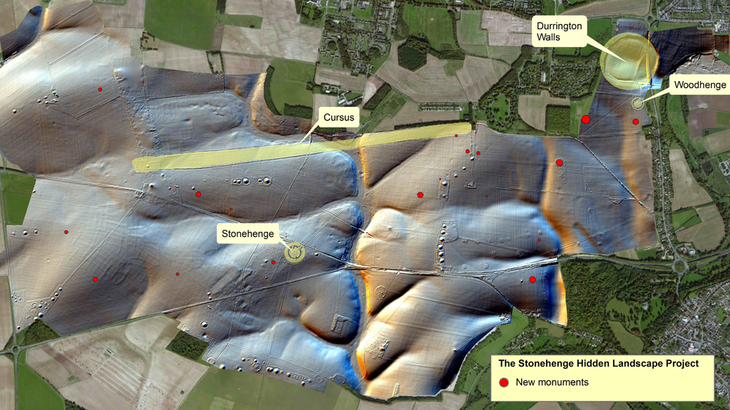
Above: a map showing the distribution of new monuments found
Dozens of burial mounds were mapped in detail by the team, including a long barrow – a burial mound dating to before 2,500m BC, when Stonehenge was constructed.
Within this 33-metre long barrow the archaeologists found a large wooden structure, which evidence suggested was where complex rituals involving the dead took place – including the removal of flesh and limbs.
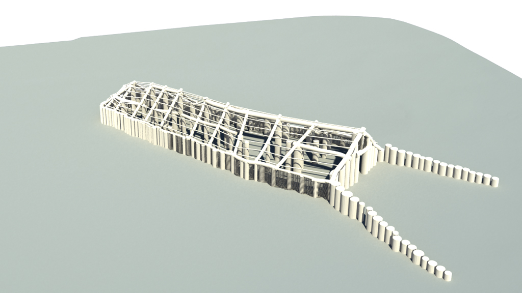
Above: 3D reconstruction of the wooden mortuary building discovered at the long barrow.
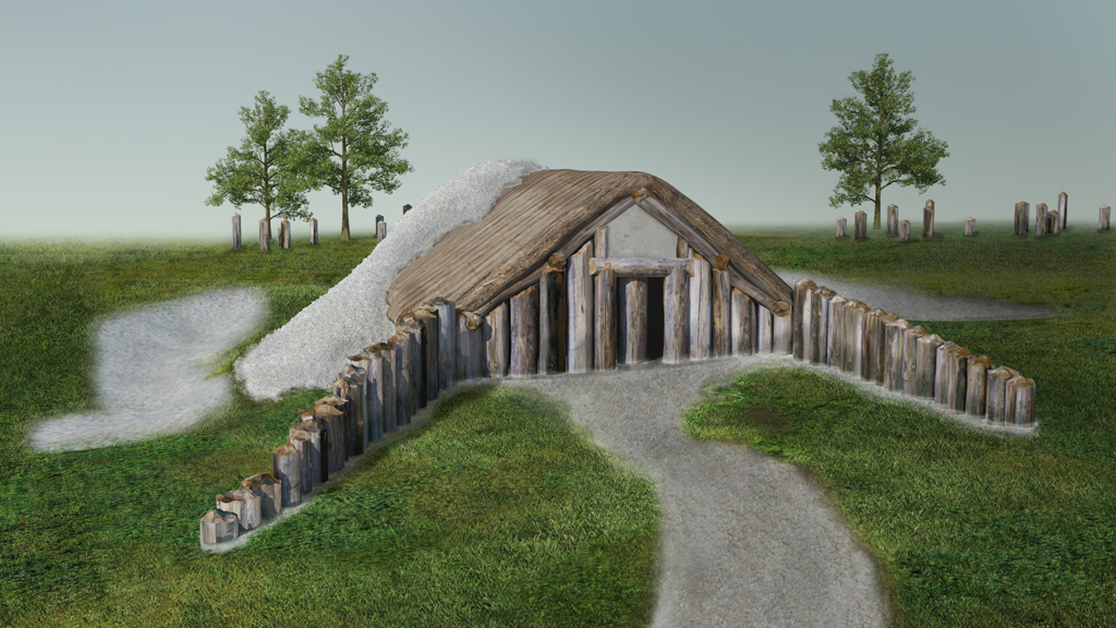
Above: visualisation of the long barrow mortuary building
The project also revealed new data on the nearby Durrington Walls “super henge” – a Neolithic settlement thought to have been home to around 4,000 people. Imaging showed the settlement’s circumference was dotted with 60 massive posts or stones, up to three metres high, some of which remain under the ground.
Other discoveries included enormous prehistoric pits, some of which appear to form astronomic alignments, and new information on Bronze Age, Iron Age and Roman settlements in the area.
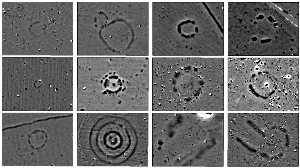
Above: magnetic data images of newly discovered monuments around Stonehenge
British project leader Professor Vincent Gaffney of the University of Birmingham, said: “Despite Stonehenge being the most iconic of all prehistoric monuments and occupying one of the richest archaeological landscapes in the world, much of this landscape in effect remains terra incognita.
We can see the whole landscape is being used in very complex ways. Professor Vincent Gaffney
“This project has revealed that the area around Stonehenge is teeming with previously unseen archaeology and that the application of new technology can transform how archaeologists and the wider public understand one of the best-studied landscapes on Earth.
“New monuments have been revealed, as well as new types of monument that have previously never been seen by archaeologists. All of this information has been placed within a single digital map, which will guide how Stonehenge and its landscape are studied in the future.”
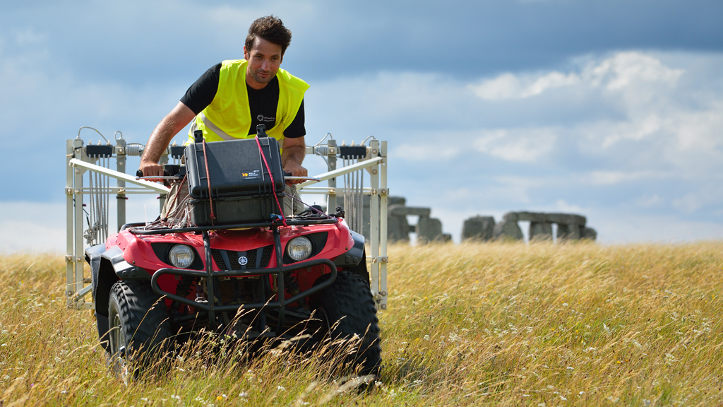
Above: a motorised “magnetometer” system carrying out a survey at Stonehenge
The way Stonehenge and its surroundings were laid out was a “highly theatrical arrangement,” Professor Gaffney said.
You have all these burial mounds along the horizon looking down at the stones. Professor Wolfgang Neubauer
“You’ve got Stonehenge which is clearly a very large ritual structure which is attracting people from large parts of the country,” he added. “But around it people are creating their own shrines and temples. We can see the whole landscape is being used in very complex ways.”
Professor Wolfgang Neubauer, director of the Ludwig Boltzmann Institute in Austria, described Stonehenge as being “more or less at in the bottom of a really big national arena”.
He added: “You have all these burial mounds along the horizon looking down at the stones.”
Picture credits: University of Birmingham/LBI ArchPro