The Great Storm of 1987: 25 years on
 Liam Dutton
Weather Presenter
It was the worst storm in almost 300 years. Many were injured and 18 people died. Liam Dutton looks at the aftermath of the Great Storm of 1987 and if a storm like it could strike again.
On the night of 15 October 1987 the nation went to bed with the expectation, based on a Met Office forecast delivered by Michael Fish, that a very windy night lay ahead.
Given the forecast the day before, what the nation didn’t expect to wake up to the following morning, was the aftermath of the worst storm to hit southern parts of the UK in almost 300 years.
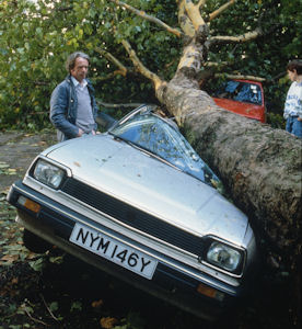
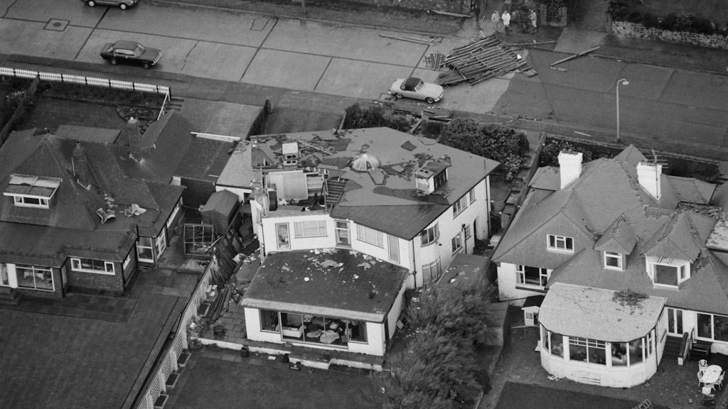
Eighteen people were killed by the storm, with many more injured – largely from falling trees, buildings and other debris, that had been battered by winds across southern parts of England widely gusting in excess of 80mph.
Millions of homes were left without power for at least a few hours, with some having no electricity for days as trees fell on power lines, disrupting supplies.

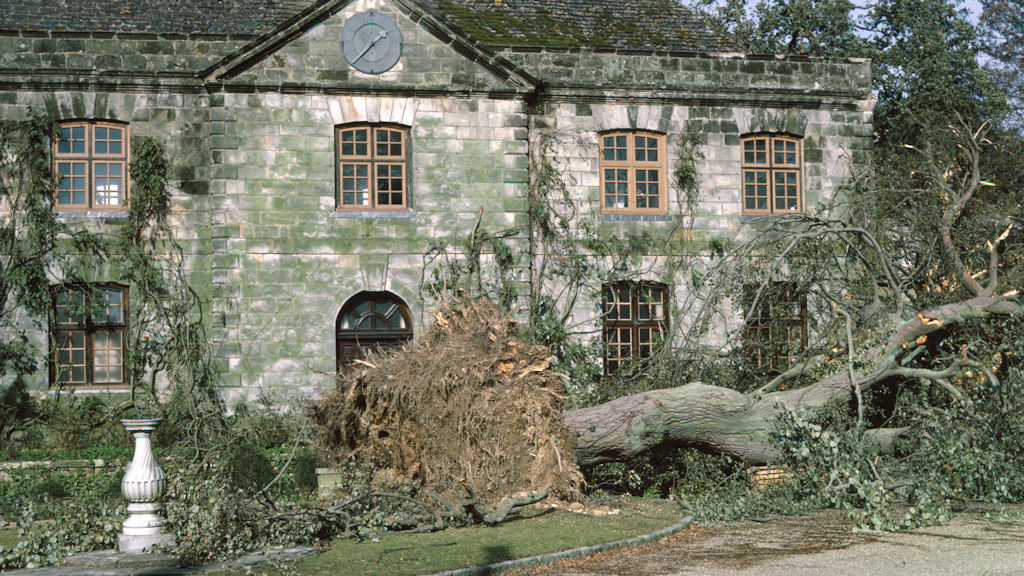
Picture courtesy of Wakehurst Place.
Transport was also severely disrupted, with road and rail in southern and eastern parts of England blocked by fallen trees and collapsed buildings, paralysing the network.
Nature suffered heavily as well. Around 15 million trees were blown over by the storm, amounting to estimated 4 millions cubic metres of timber.
The town of Sevenoaks saw six of its famous oaks toppled and Toys Hill in Kent lost 97 per cent of its trees to the storm.
What caused the storm?
On 15 October, there was a sharp temperature contrast in the Bay of Biscay, where cold air from Iceland collided with warm, moist air heading northwards from the sub-tropics.
In meteorology, sharp temperature contrasts often provide a focal point for severe weather developing, as the warm, moist air is forced upwards over cold air.
This mass ascent of air leads to clouds and rain forming – especially when the temperature contrast happens over a relatively small distance.
The second contributor was the jet stream – a fast moving ribbon of air high up in the atmosphere that determines how weather systems form and where they go.
On this particular day, the jet stream was much further south than normal for mid-October. It was also moving very quickly, which had the effect of sucking up air from the surface and causing a rapidly deepening area of low pressure to form.
The above two factors combined bred a storm that tracked north eastwards across England, taking an area of destructive winds with it.

Where was worst hit?
Whilst most of England and Wales experienced wet and windy weather that night, it was southern and eastern parts of England that were worst hit.
This is because the worst of the winds were experienced on the southern side of the storm as it tracked north eastwards across south west England and the Midlands, before heading out into the North Sea.
Gusts of wind in the worst affected areas were in excess of 80mph, with a gust of 94mph recorded in London during the early hours of 16 October. The highest gust recorded from the storm was at Gorleston, Norfolk, hitting 122mph.
Was it a hurricane?
Technically, the Great Storm of October 1987 was not a hurricane, although the strength of the wind in some places was of equivalent force.
A hurricane is a storm that needs a tropical environment in which to develop and thrive, where sea surface temperatures are 27C or more and there’s an abundance of tropical moisture to feed upon.
These conditions just aren’t present in the vicinity of the UK, so the storm couldn’t have been a hurricane. It just happened to be a very powerful variant of the mid-latitude low pressure systems that we typically see each autumn.
Read more from Liam Dutton on the Channel 4 Weather site
Could a similar storm happen in the future?
There is no reason why another storm on the same scale couldn’t happen in the future, although given that it was a 1 in 200 year event, it may be sometime before something similar is experienced.
On the other hand, climate change is influencing our weather and how it behaves. In the future, severe weather events are predicted to become more extreme and possibly happen more frequently in comparison to what they would have in the past.
However, continuing developments in science, technology and communication should mean that forecasters are better positioned to predict and warn of the dangers somewhat earlier than they were during that night, 25 years ago.
